Now that spring has finally arrived (knock on wood), is it safe to talk about what just happened and what it means for our water future in the upper Midwest?
You’ve all probably noticed we have been getting stuck in persistent weather patterns. Our cities are already thinking about how that impacts them and some are redesigning their water infrastructure to handle bigger snowstorms, melt events, and rains.
 Why is this happening now in a time of global temperature rise? Dr. Jennifer Francis of the Rutgers Department of Marine and Coastal Sciences has been researching connections between rapid Arctic warming and weather patterns in mid-latitudes ever since she took a sailing trip to the north and was alarmed by what she saw.
She is our next guest in the Moos Family Speaker Series and will be presenting her work on Wednesday, May 9 at the St. Paul Student Center.
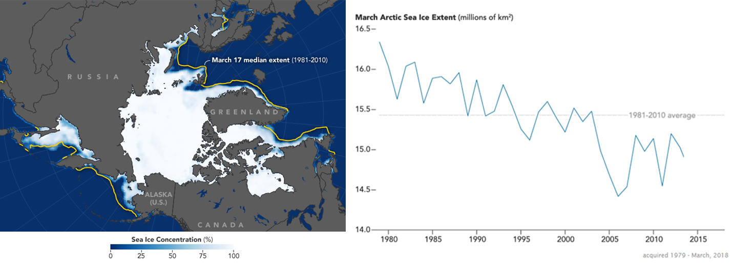
NASA satellite records show Arctic Sea ice shrinking for the past 40 years.
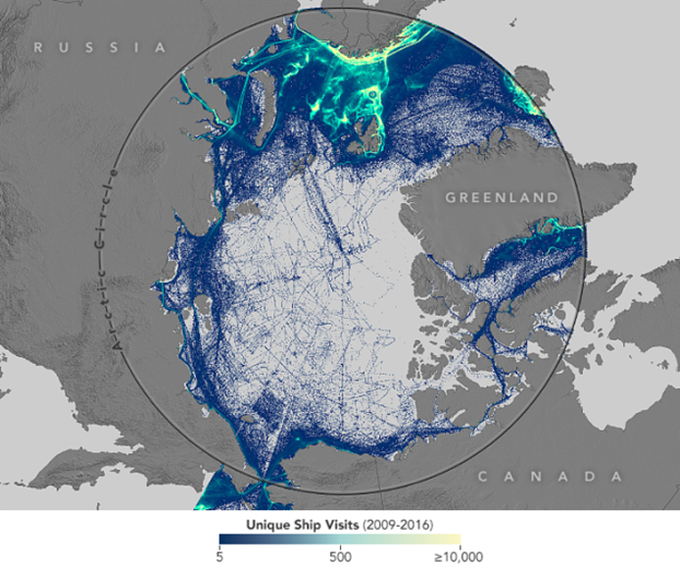
The impacts are not limited to polar bears, plankton, and far-away people. And we can’t just put a positive spin on it and say that the disappearing ice is making it possible for ships to take a short cut across the pole.
Come and hear Dr. Francis explain the connections that link a warming Arctic to the persistent weather regimes we are experiencing in the mid-latitudes. Reception is at 5:30 p.m., lecture at 7:00 p.m. Event is free (thanks to supporters Barr Engineering, the Consulate General of Canada in Minneapolis, and the Shingle Creek and West Mississippi Watershed Management Commissions) but register to save your seat. We expect a full house! (Learn more and register.)
— Carrie Jennings, research and policy director