 Groundwater governance in the Great Lakes region (April 2025)
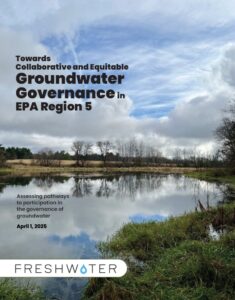
Freshwater completed a multi-year project to advance groundwater governance in the Great Lakes region. This work evaluated current management structures, practices and challenges.
The project team also compiled best practices and recommendations to develop regional groundwater governance systems based on common understanding that fosters inclusive prosperity, ecological health, and repairs past harm, while being resilient to climate and population stresses over the next generation. View the latest report here.
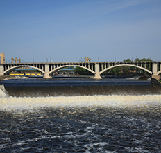
Freshwater is working with the University of Minnesota on a study of the St. Anthony Falls cutoff wall, which was originally constructed in 1876 on the Mississippi River in downtown Minneapolis. To learn more about this unique infrastructure assessment, visit the project website.
The Minnesota Department of Health (MDH) is currently developing a 10-year drinking water plan to better manage drinking water in Minnesota, and Freshwater is playing a key role in engaging water professionals and the broader statewide community.
Freshwater worked with the MDH, University of Minnesota’s Water Resources Center, the Humphrey School of Public Affairs and Clean River Partners to host a series of focus groups centered around drinking water management and governance. View the report.
Study will map potential to recharge Minnesota aquifers (November 2023)
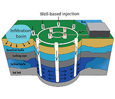
With groundwater shortages becoming a concern in some areas of the state, researchers at the University of Minnesota and Freshwater are developing a first-of-its-kind GIS mapping tool that could help pave the way for managed aquifer recharge in Minnesota.
Also known as water banking, managed aquifer recharge usually involves injecting water into the ground through wells, or constructing infiltration basins, to essentially “bank” water underground to be used later for drinking or irrigation. Freshwater’s primary role will be to communicate with state agency personnel, tribes, legislators and other stakeholders – and to make policy recommendations that would allow managed aquifer recharge to be more easily implemented in the future.
Published in the Journal of Hydrology: Regional Studies, this peer-reviewed paper is a result of our Banking Groundwater report developed in collaboration with the University of Minnesota. View the paper.
This study was designed to investigate the occurrence in the environment of a class of compounds, Nonylphenol and many nonylphenol ethoxylates that have been used since the 1940s as detergents and surfactants, among other things. They are known endocrine disruptors and can be produced in wastewater treatment plants. The goal was to document the current concentrations of NP and NPEs within the Twin Cities’ metropolitan watershed and assess how they have changed over time. Read the full report.
 Hennepin County Bedrock Collapse Project (July 2021)
Hennepin County Emergency Management contracted Freshwater and Midwest Geological Consultants to identify areas where bedrock collapse could lead to sinkholes.
The County will use results of this investigation to highlight risk to the public, similar to their landslide atlas, allowing stakeholders to take action to mitigate that risk. Read the full report.
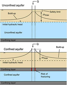
 Banking Groundwater: Managed Aquifer Recharge (December 2020) addresses the issue of the more than 75% of Minnesotans who rely on groundwater and may find it in short supply in the face of population, land-use, and climate change. Aquifer storage and recovery (ASR) is a technological approach to treat and inject clean water into an aquifer for temporary storage.
This study examined four different kinds of aquifers across Minnesota with unique pressures to determine their suitability for ASR. Read an executive summary or the full report.
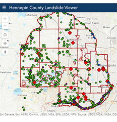 Hennepin County Interactive Landslide Map and Hazard Atlas: December 2020
The Twin Cities has experienced an increase in landslide activity over the past decade as a result of increased precipitation.
This interactive map of landslides and atlas report can help watershed districts and cities manage surface water to reduce the risk of landslides.
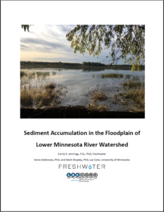 Sediment Accumulation in the Floodplain of Lower Minnesota River Watershed (June 2019) provides a direct assessment of sediment accumulation in the floodplain of Lower Minnesota River Watershed to better document how sedimentation in this reach has changed as a result of changes in flow in the post-settlement period. Download the report.